Some buds and I went to Tofino BC, which is – dare I say – the surf capital of Canada!
We hiked, we surfed, we drank beers, but we mostly surfed, and I captured some footage from the sky of the beauty that is Vancouver Island.
Some buds and I went to Tofino BC, which is – dare I say – the surf capital of Canada!
We hiked, we surfed, we drank beers, but we mostly surfed, and I captured some footage from the sky of the beauty that is Vancouver Island.
In July, 2018, we spent a few weeks driving around Scotland, and during that time, had a chance to visit the Isle of Skye. We camped near the fairy pools, wandered around the epic Neist point, were entranced by the fairy glen, said hello to the Old Man of Storr, and hiked through the Quirang.
Here is a video compilation of our epic road trip about this most beautiful place.
Music: Line of Sight (Reprise) [Instrumental] by ODESZA
What to read next: Three Days in the Isle of Skye
Our time on the Isle of Skye were unforgettable. The island boasts epic walks, beautiful views, and some of the most spectacular coastline I’ve ever seen. It is easy to get around too, so you don’t need too much time to see a lot of it. That being said, I could have stayed another week, driving, discovering, and wild camping in magnificent spots.
Want to watch another video? Check out The Ultimate Slovenia Itinerary
To read about our epic road trip, and see the stops on our Slovenia itinerary, click here and check out this post!
Check out my fave places in Slovenia:
The perfect day in Lake Bled
A Wine Tasting in Brda Wine Country
Spending the day in Ljubljana
Summiting Triglav


We arrived at the Berg Lake Trail parking lot and joined the group of eager hikers gathered around the information desk. After a quick safety briefing, we watched a quick video, and then went outside to the big deck behind the building. There, standing at 3,954m (12,972ft), scraping the sky, was Mt. Robson. There was not a cloud in sight — a rarity for the area — and Robson looked as mighty as ever with a bluebird sky surrounding it. We jumped back in the truck and drove down the road to the trailhead.

From the trailhead to the first campsite, and our first snack stop, at Kinney lake, is 7km. The trail is wide and well traveled by both hikers and mountain bikers. Michael had the idea to cheat a bit. We could mountain bike the first 7km, save ourselves some time, then lock the bikes at Kinney and continue on foot! I wouldn’t necessarily call it cheating — I heaved my 50 pound backpack up and onto my back, adjusted my helmet as best I could so the top of my pack wouldn’t keep knocking it over my eyes, and took my seat on a mountain bike for the very first time. It was hard; hard to keep balance with a heavy pack, hard to bike up hill with the weight, hard to go downhill without feeling like I’d fly over the handlebars. But of all the pain I was feeling in my back, my lungs, my legs, my wrists, it was my butt that hurt the most. We finally arrived at Kinney and locked our bikes next to the others on the bike rack, and my butt and I were relieved. (Read about the time we took bicycles around Tuscany!)

We stopped next to the lake for a quick snack, and then continued the hike up to our next snack stop, Whitehorn campground. The climb up was tough. There were stretches that were just straight uphill for what seemed like an hour! My layers came off and I wore just a t-shirt and hiking pants. We hiked through deciduous forest and the fall colours were just spectacular. The blue sky, the orange leaves, the brown of the trail, it really was autumn at it’s best. At Whitehorn, we sat down by the river, pumped some fresh water into our bottles with the filter, and chowed down on some nuts and berries.
Whitehorn is where a lot of people decide to spend their first night. Those people are sensible. We are not sensible people. Today we are hiking all the way to Berg Lake. We continued through forest and came to the bottom of a hill. Michael said, “this is where the real climb begins.” WHAT?! We had already biked and climbed 11km and 300m, and now the climb begins? Yes, because Berg Lake is another 11km and 700m up. See? Not so sensible.
I don’t have to go into detail. The climb was hard, I was sweaty, the end. We stopped by Emperor Falls on our way up. The falls were not as full as they are in the spring, with all the run off, but from where we sat, with the falls booming in front of us, and Robson standing high above, it was a pretty epic snack spot. (Read about another epic climb we did to the tallest mountain in Slovenia!)

We arrived at our campground, Marmot, where we would stay for the evening. We went down to Berg Lake and pumped some more water into our bottles. There, across the water, was the giant, and utterly bewildering, Berg Glacier. We were pumping glacial water into our bottles. It doesn’t get much fresher than that! The glacier rumbled and groaned. Tremendous cracks, like thunder, echoed across the lake and through the valley. I stood on the shore of the lake, unable to move my legs, and felt my chest vibrate with the sound. Whoa.

We set up our perfect little tent, inflated our Thermarests and air pillows (I know, boujee), and began making dinner. Tonight we enjoyed Indian food! Lentil curry over rice. Nothing beats a hot meal after 22km of hiking.
I slept well, considering the colossal cracking of the glacier continued through the night. This morning, we would cook some breakfast couscous. I prepared the mix at home by combining couscous, with cinnamon and sugar, and some dried fruit and nuts. I felt pretty fancy! But, like an idiot, I forgot to write down the ratio of couscous to water, so this morning we had to guess. After our breakfast of sweet couscous soup, we enjoyed tea and coffee down by the water. The bluebird, cloudless sky from yesterday, was now covered by a thick layer of clouds. The top of Robson hid behind them, and the glacier disappeared into the cover. After our lovely, lazy morning, we continued onto our next camp spot, at Adolphus Lake only 7km away.

We walked through forest, across gravel flats, through a swampy field, and yelled “HEY BEAR” the whole way. I love a good wildlife sighting, but I just wasn’t keen to cross paths with a bear today. We arrived at the campsite and set up our home. The whole reason we came to Adolphus lake, is so we could cross the provincial border back into Alberta, where, under the Jasper Parks rule, we could build a campfire. We went on a mini adventure around the lake, and on the way back to the camp, collected a bunch of firewood.
This evening, we had the place to ourselves. We built a big, beautiful fire and set up a couple of logs around it so we had a table and two chairs. We played dice! I kicked Michael’s ass. My achilles tendons were starting to fatigue after our long day yesterday. I took off my boots, held my feet to the fire, and massaged my calves a bit. The sun went down and we climbed into bed. Once our headlamps were off, it was pitch black. There was not a sound around us. Now this is private.

When, I woke up this morning, and looked up to see the fly of the tent pushing on the inside walls. I put my hand up to push it off, and a HUGE layer of snow slid off the roof of our tent. I zipped open the door and stuck my head outside. Greeting me this morning was a thick, fluffy blanket of snow, coating the ground, hanging from the trees, covering our tent. It was still snowing. The magical flakes floating down were big and fluffy, and landed on the ground without a sound.
Our breakfast couscous was much less soupy this morning. We packed up some snacks in our little daypacks, hauled our food up into the bear hang, put our big backpacks in the tent, and left for an adventure! My achilles tendons were so tight as we started walking. I popped an Advil — extra strength — and hoped it would numb the pain.
We hiked back to the BC side of the valley, and took a left towards Snowbird pass. The climb was difficult and my achilles were giving me such a difficult time. Then I had the thought, “they are ‘achilling’ me,” and I laughed. The clouds continued to move, and before we knew it, the valley was socked in. Our day trip to Snowbird ended with lunch just below the cloud line. We still had an epic view from our snack spot, looking out over the Snowbird glacier and down the whole valley from where we came. On the hike back down we saw mountain goats! They sat, high up on a sheer rock face, just hanging out, escaping the wind. Now that’s the kind of wildlife sighting I like — from afar!

We continued our walk back to camp. On the way was a huge, dead tree, laying next to the path, with so many perfectly dry branches for a fire, so we began collecting some. I was able to balance a bunch of wood on my daypack, and Michael took a few armfuls. Here, I thought we were only a few hundred metres from camp. Turned out, we were over a kilometre away. I trudged through the mud and snow with an enormous bundle of wood, laughing at our premature firewood collecting.

We arrived back at our tent and met Andrea and Phillip, two folks from Edmonton who are on the last night of their eight day trek along the North Boundary Trail. They confessed we were the second couple they had seen on their entire journey, but it wasn’t hard to know; they couldn’t stop talking, telling us stories of what they had seen, the rivers they crossed, the meals they ate, the wildlife they ran into, the sunsets and sunrises they enjoyed. I was happy to be the first to hear it all!
Both Andrea and Philip, and Michael and I were enjoying our last night in the backcountry. My favourite thing about the last night of a big hiking trip is eating ALL THE FOOD you have left. We had such a feast — noodles, Indian food, miso soup, chocolate — and enjoyed the gigantic fire we built with all that wood. The snow began to fall, the wind picked up, and when the sun went down, we retired to our tents.
We were up early this morning. Not as early as Andrea and Phillip, but early for us. I climbed out of the tent, and went to the bear hang to retrieve our food, then, I set up the stove and began cooking while Michael packed up our camp. Today the breakfast couscous was perfect. TOTALLY perfect! We enjoyed our breakfast and warm drinks under the skirt of a huge fir tree, staying out of the snow for as long as we could before hiking through it.

The path was covered in snow, thankfully, we could follow Andrea and Phillip’s footsteps to stay on the trail. My achilles are absolute hell today. I popped another few pills and tried my best to hike through the pain. We were only a few metres from the border of Alberta and BC, and across the path were fresh bear tracks. The tracks were on top of Andrea and Phillip’s, and oh, so perfectly clear. For me, this is the ultimate bear sighting.

We walked all the way to Berg Lake, where we stopped for a quick snack, and then continued on all the way to Whitehorn. Here, we stopped, took out the stove, and cooked up our last pack of noodles for lunch. A couple sat nearby and we chatted with them. They had also just come from a multi-day camping trip to Berg Lake. They looked to be in their 60s! I hope to continue to be as active as I age.
Finally, we arrived at Kinney Lake, and never did I ever think I’d be so happy to see that damn mountain bike again. The ride down was much easier than the ride up; my pack was lighter and much smaller, and I had the greatest motivator of all — desperation to get off this dang mountain! We flew down the hill, passing other hikers as we went. And then, lo and behold, passed Andrea and Phillip! Ok, now I understand why the bikes feel like cheating.
When we arrived at the truck, my face was speckled with mud, my achilles tendons were tight as can be, my shoulders were raw, my lungs exhausted, and the biggest, goofiest smile plastered across my face.

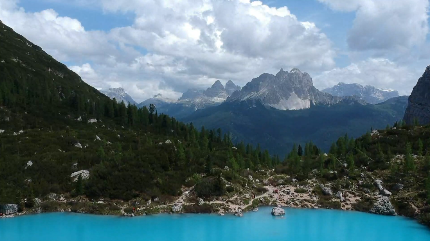
We were up and at ‘em at 7am — not a common occurrence these days — and were scarfing down a hearty, hiker’s breakfast, by 7:15. The weather forecast for the day boasted a beautiful, sunny morning, and threatened afternoon thundershowers, hence our early start. Michael made a pot of coffee, and brought it to our French neighbours in the van next door, they had come over last night to ask if we had any weed, and even when we told them no, we ended up chatting for about an hour, Gavin and Tiffany, and their dog, Nina. They too, were up at 7 today to do the hike up to Lago di Sorapis. Last night, we parked in a big meadow under a bridge, next to a waterfall. Sounds idyllic, but the real dream of this spot was that we were a two minute drive from the trailhead!
We pulled up to the start of the hike, where only a handful of other cars were parked, and with a quick check to make sure we didn’t forget anything important, like the gummy bears, we began! The beginning of the trail was nice and easy. It was a bit of a climb, but the shade from the beautiful pine tree forest around us, made it very manageable. We came to a clearing in the trees and for the first time today, caught a view of the valley. Just totally spectacular. The Dolomites are a crazy mountain range. The mountains emerge from the ground as little mounds, and then, huge, flat walls, rocket up to become craggy peaks. The mountains we were looking at were no different, and the valley was wonderfully wide, giving us such a view. It’s views like this that make me want to climb higher and higher — if it’s this good now, imagine what it will be like 800m up!
The path emerged from the forest and we left the shady cover of the trees. Our peaceful, pleasant walk through a forest, became a rocky, sun-drenched, trail with a hefty drop on the one side. We held on to the cables bolted into the rock beside us, to give us some peace of mind about the cliffside, and took it nice and slow. We were directly in the sun at this point, and the sweat really started to roll. Nina’s tongue was dangling out of her mouth, and she was panting away.
We finally reached a fork in the road, with a signpost informing us the lake was only a few metres away. We took a few more steps up the trail, and as we crested the hill, we could see Lago di Sorapis. Oh. My. God. The water in this lake is ‘out of this world’ blue. If you had told me it was radioactive, I would have believed you. The icy, almost opaque turquoise lake was surrounded on three sides by huge, rugged peaks, and with no wind, they were reflected almost perfectly in the water. We stood for a moment, just staring at the view, experiencing what I like to call ‘summit brain’ (the phenomena in which the hiker, after experiencing intense muscle fatigue, great physical exhaustion, and, often, mild dehydration, forgets all of the aforementioned ailments upon reaching the summit of the mountain, or the ‘summit’ of the hike).
We walked a little ways around the lake, in search of the perfect lunch spot. I believed I found it, a big, flat rock protruding out into the water, but when I arrived, I discovered it wasn’t protruding at all, that it was actually surrounded by water. That didn’t stop Gavin! He stepped out to the rock closest to our lunch rock, and without hesitation jumped up, and heaved himself up onto the platform. One by one, we followed suit. Michael first, and then me. I jumped and somehow managed to pull myself up onto the rock. Woohoo! Now we really deserve lunch! I ate my wrap and dipped my feet in to the water below. It’s freezing!

After we enjoyed our lunch (and gummy bears), we continued to walk around the lake. We came to a crystal clear creek and filled our water bottles. Nearby was some leftover snow, the sun hadn’t melted yet. I’m not sure who started it, but someone discovered it was the perfect snow for snowballs. So, like the children that we are, we threw snowballs at each other. We giggled like idiots, as we tossed the snow around.
Then, it was time to go. We stood for a few moments, soaking in the views. Sure, we have photos of this place, but they don’t hold a candle to actually being here. We walked back to the fork in the road, and followed the signpost directing us to the loop. We began the walk down, a terribly steep path. The steps were uncomfortably big, and the sun was still beating down on us. We walked and talked, trying to take our minds off this ridiculous trail we chose, until a few hours later, we reached the bottom of the valley. Michael consulted his phone and the hiking app we use. We were close to the end in time, but not in kilometres. The super steep way down took ages, but we didn’t cover much ground. We walked and walked and walked. Then, when we were only about 5km from the end, we began walking uphill again. What?! Uphill both ways?! I looked at Nina, she looked at me as if to say, “why the F aren’t we home yet?” We stood in the path for a moment, all desperately trying to summon the last morsels of energy from deep down within. I gasped! I ripped open my bag, and fished out the near empty bag of gummy bears at the bottom of my bag. There were four left. We each took one and allowed the sugarto coarse through our veins. Let’s go!Up we went, sweat pouring down our faces. And then, just to top it all off, the skies opened up, and the rain began to fall. I was too exhausted to get out my raincoat, we all were, so we continued in t-shirts as the warm drops fell. I didn’t complain, it was actually quite a welcome relief from the sun.
We arrived at the road, and over the top of just one more hill, I could see the van! Van, sweet van. We drove back to the parking spot under the bridge to share one more meal with Gavin and Tiffany, before we separated ways. What an epic adventure to share with two strangers! The sun, the lake, the views, the company, all of it was spectacular. Yet again, the Dolomites didn’t disappoint.
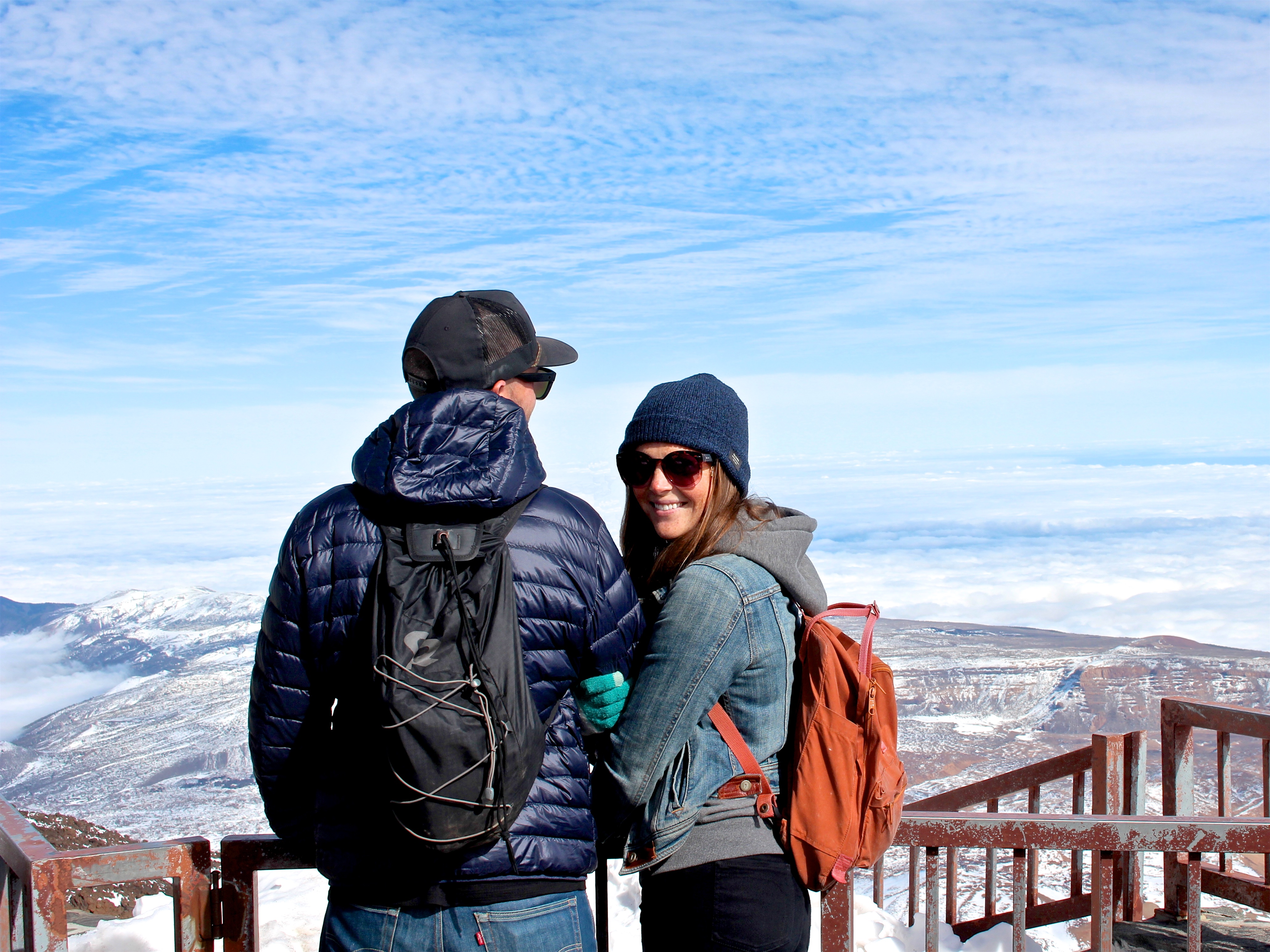
Michael and I took a vacation from van life for three weeks. In that time, we met up with my mom and dad in the Canary Islands of Spain. This is a story about the day we went up to the top of the volcano on Tenerife.
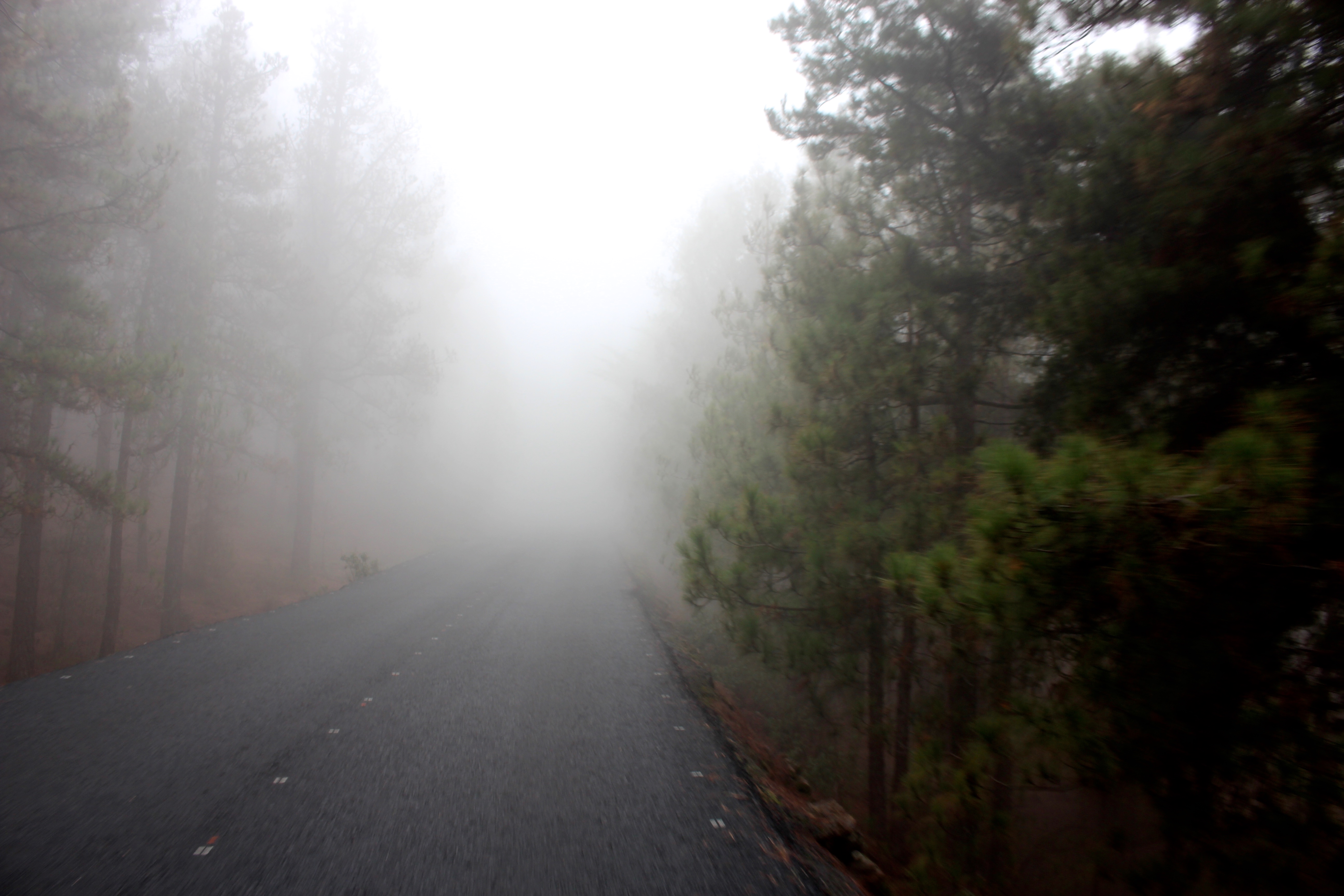
We drove up and up along the worst winding road ever. Battling motion sickness, I sat in the front seat, willing my stomach to just chill, and my gag reflex to not overreact. We had driven for about an hour, up so high into the hills, and then into clouds. We couldn’t even see the road 50m in front of us. Cars would seemingly appear out of nowhere, we couldn’t see where the road turned, only when trees stood right in front of us. We drove about 20km/hr the whole way.
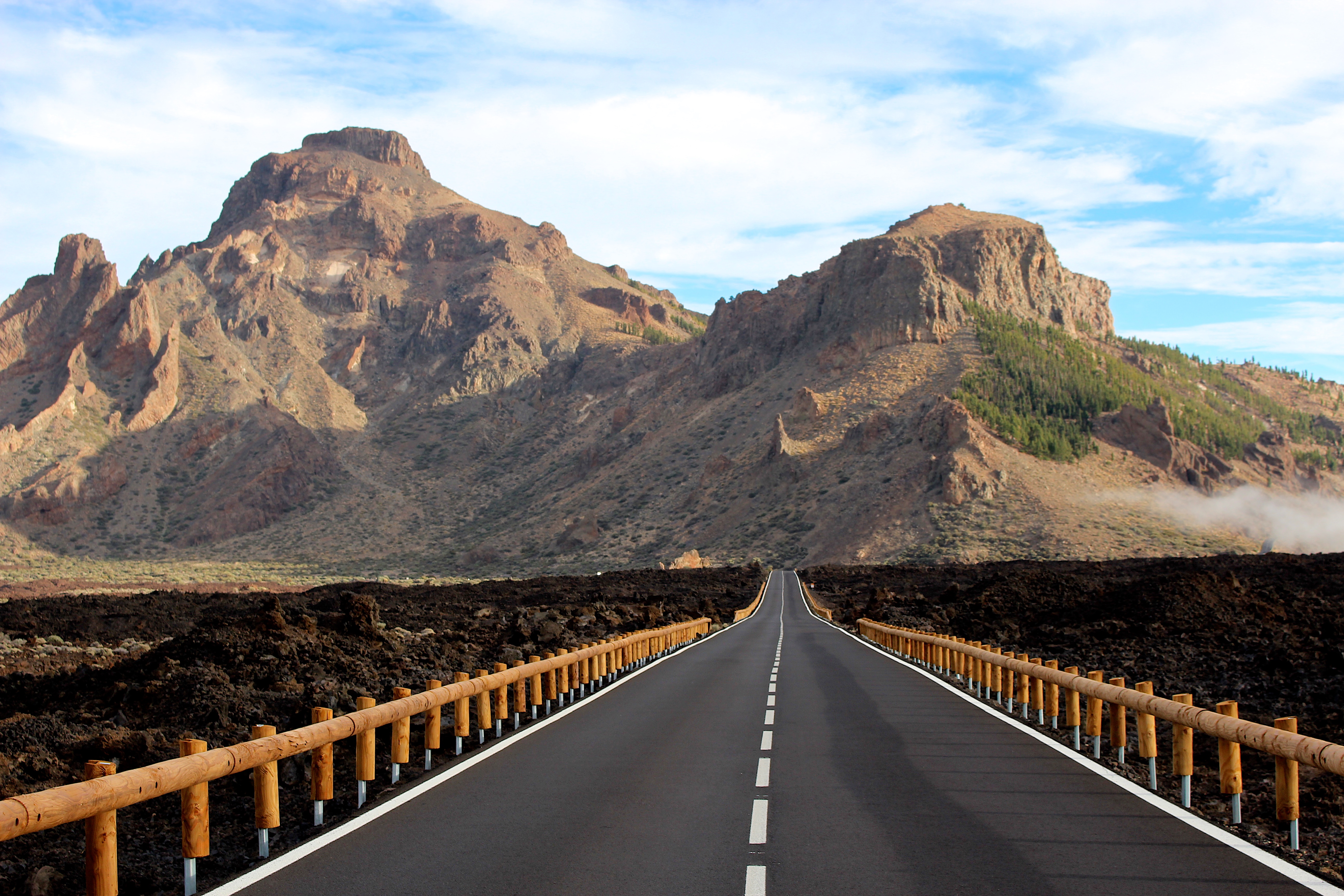
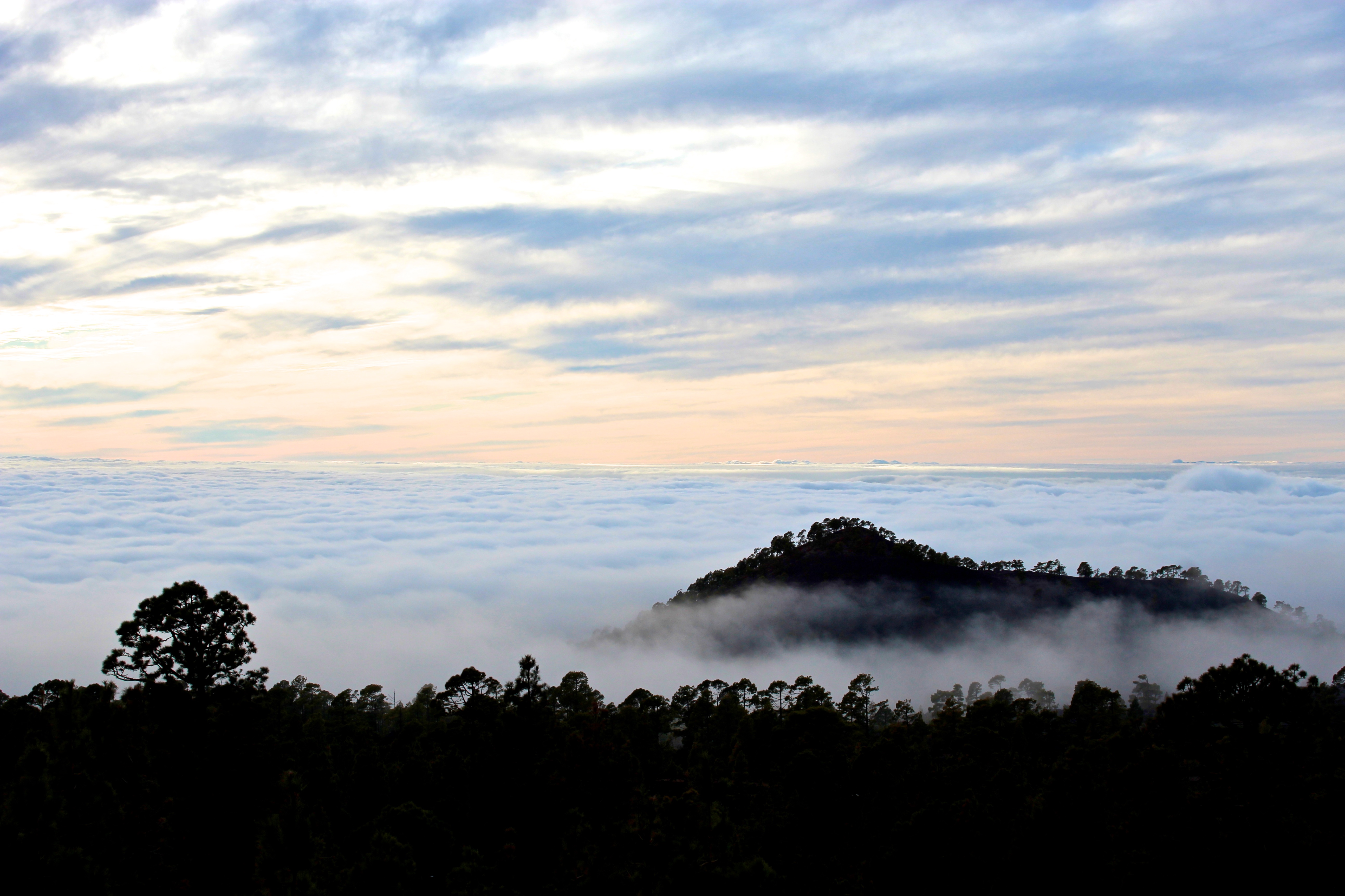
And then, just as soon as they appeared, the clouds dispersed! The sky was blue blue blue, and there was not a cloud above us. The ground was dusted with snow, and the farther up we drove, the more snow we saw. We came to a clearing and saw people sledding down small hills. They used body boards as toboggans! I learned a while ago that the El Teide National Park is the most visited national park in Spain, followed by Lanzarote, and then the Picos de Europa. This meant the roads were PACKED! And not wide enough to be so busy. The parking lots were busy with Spanish drivers and people in rental cars, and of course, the snow and ice from yesterday had turned to slush in the heat of the sun today. Dang, it was hectic. We got honked at a bunch of times but we weren’t too bothered. The park was stunning. The volcano, the sky, the surroundings, all of it. You can roll your eyes all you want, silver Subaru, but nothing can get us down.
We arrived at the base of Teide and parked the car. We walked up the gondola station and found the ticket office. We went to the desk and stood behind a family. The lady at the ticket desk give them a really sympathetic look. The family turned around, disappointed, and walked away. When it was my turn, I walked up and said, “you’re sold out, aren’t you?” She nodded with the same sympathy. NOOOOO! We stood nearby and chatted about it. Mom, dad and I stood there, talking about how we didn’t need to go up anyways, that it was just as beautiful down here. Michael, on the other hand, walked over to a different ticket desk. He said he was going to ask about how to buy tickets for another day. He came back with four tickets for the cable car. They were for 4:30pm. What?! Magic Michael!
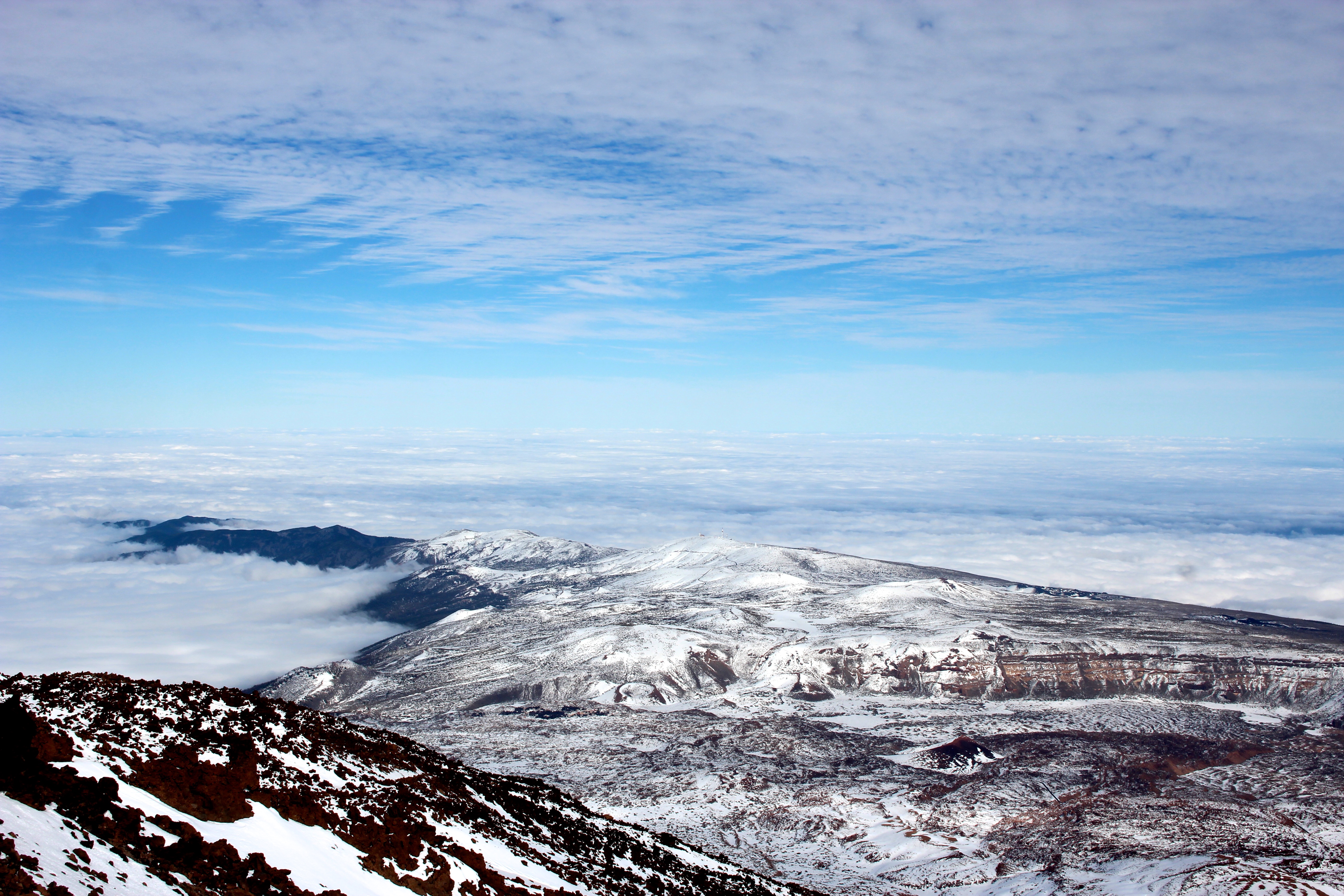
We went outside to the ticket man and asked if we could use our 4:30 tickets even though it was only 2pm. He nodded and let us go through. WHAT?! This day is magical. This volcano is magical. It wants us to go to the top. The cable car was quick, with a few stomach-in-your-mouth moments along the way. We reached the top and my, oh my. We donned our toques and gloves to fight the biting wind. The view was totally breathtaking. Or it was the altitude that was breathtaking, the volcano is higher than 3000m. We were above the clouds. Like, hundreds of metres above the clouds. The clouds gave us such a bizarre perspective, it was cool. We walked around the observation deck and took pictures. Mom pulled out the sandwiches she made for us and we sat on the wall and ate them while looking out at the whole world.
We took the cable car back down. Toques and gloves off, we walked back to the car. We wanted a close up view of the lava nearby, so we went for a quick walk through some old flow. Lava is so cool, you guys. The road through the park was stunning. More lava, older flows, huge rock formations, crazy colours, my finger on the shutter of my camera was going wild. We were above the clouds, about to go through them, and we stopped for photos. Dang, Earth, you pulled out all the stops today!
My first time in Spain, I travelled the south and the Mediterranean coast — Seville, Valencia, Barcelona, Madrid. It was all so beautiful! I fell in love with the food, the weather, the beaches, the architecture, and the history. Spain is gorgeous! That being said, there is a lot more to Spain than the south. In fact, the north of Spain has some of the most breathtaking landscapes I have seen. The north is stunning, and I would argue wildly underrated (and under-visited).
In 2017 I spent two months driving along the north cost of Spain in a van named Vinnie. We drove into Spain along the west coast of France, and drove next to the ocean (almost) the entire way through to Portugal! Along the way, I discovered that the north of Spain is amazing; breathtaking landscapes, beautiful architecture, and rich cultures.

The Picos de Europa is a super stunning mountain range in the north of Spain. The mountains here are perfect for hiking, bicycling, climbing, and more! The roads are beautiful to drive, the scenery is out of this world, and what better way to see a country than from the top of a mountain? We did a few different hikes while we were in the Picos de Europa. We did an easy day along the Ruta del Cares, a quick hike up to Bulnes, and a bigger hike up to the summit of Torre de los Horcados Rojos near Fuente Dé. We also did a via ferrata, which was a totally killer experience.
For more information about hiking in the Picos, check this out! And read about my via ferrata experience here!

Bilbao is the capital of the Basque country. It is the home of beautiful architecture, great shopping, and delicious food. Home also, to the infamous Guggenheim museum. What? But I thought that was in New York? Yes! So did I! Turns out there is a Guggenheim in Bilbao too, and I might argue the architecture of the Spanish Guggenheim outshines that of New York (sorry to offend the beehive fans). There is much to do in Bilbao, wander around the shopping district of Indautxu, drink a tinto de verano while sitting along the too-cool street, Erronda Kalea, or just sit on any bench by the river and watch the people go by.

Logroño is the capital of the La Rioja wine region in the north of Spain. La Rioja is home to wineries that export their wine so far and wide, that I can buy a bottle in the local wine shop in my hometown of Calgary, AB, Canada. There are some big wineries here. Which means, there are lots of people, and lots of good food. Take an evening to stroll down the street of Calle San Juan and try a pintxo (pronounced peen-cho) from each place. Pintxos are tapas in the Basque language. Start at Bar Angel with a tower of garlic mushrooms and a glass of red, and at each place order a pintxo and a wine, pintxo and a wine. Then you’re doing it like a local!

As I mentioned, La Rioja is home to some big, beautiful wineries. There are plenty of small wineries too! Sure, you can go winery hopping by car, but what fun could that be for your sad friend who has to drive? Bicycle is the only way to get around wineries. Now, a disclaimer: some of the wineries are on top of hills, some wineries are far away from each other, we planned our route accordingly — knowing that we would have a few glasses of wine at each place, and add weight to our backpacks with the bottles purchased. We rented bicycles from Navarent (their website here), and went to as many wineries as we could in half a day. Seven tasters and five bottles of wine later, we called it a successful day!
(More tips and tricks about Rioja and wineries here).
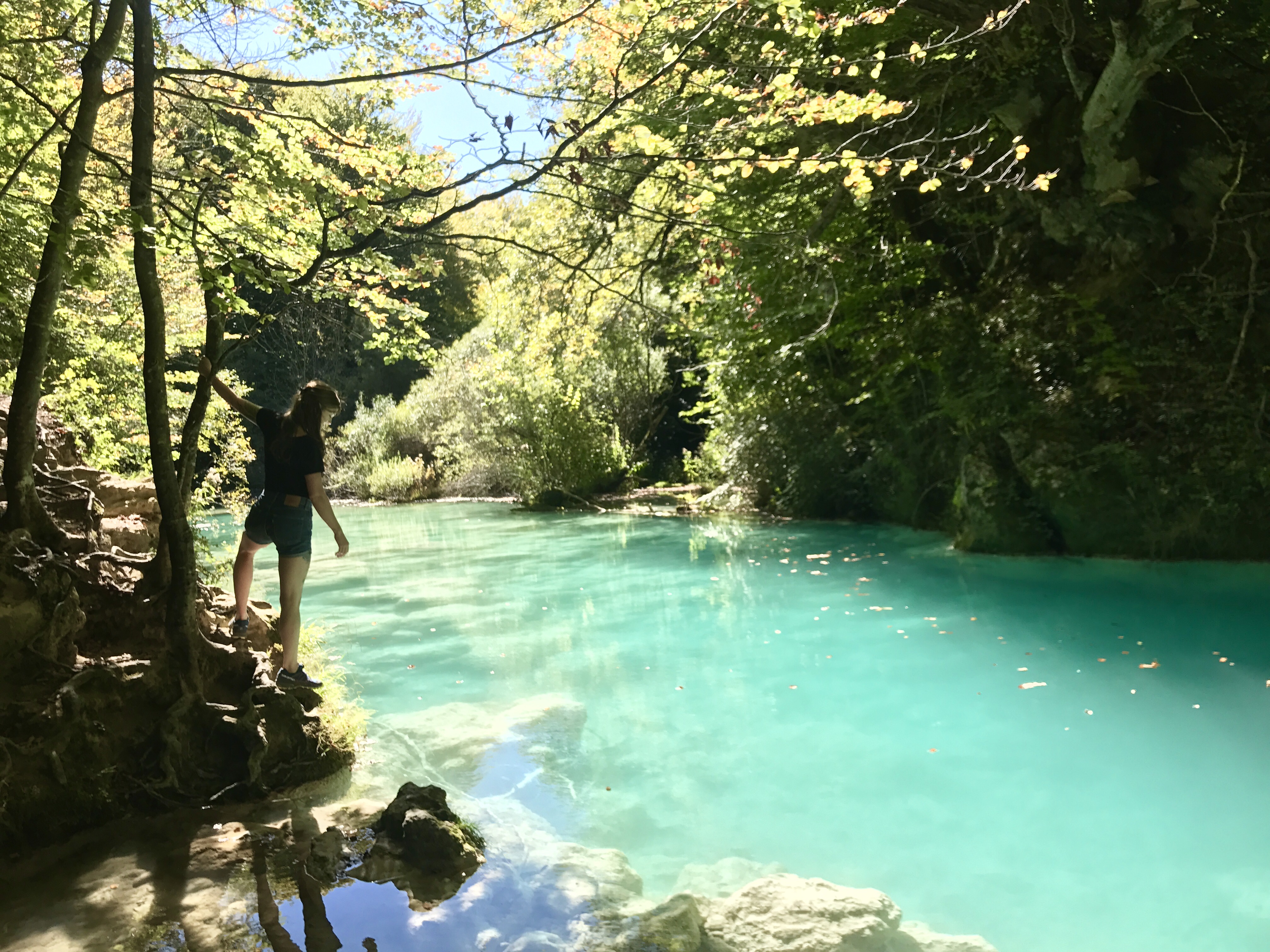
As much as I love eating decadent food and drinking delicious wine, I feel like I can’t really get to know a place if this is my only activity. Just an hour outside of Logroño snakes one of the most beautiful places I think I have ever been, the Rio Urederra, or “The River of Beautiful Water.” This place is a magical getaway from the crowds, the bustling of the towns and villages, and the perfect place to spend a day. The walk is easy and takes about 3 hours, maybe more because if you’re like me, you will want to stop at every lookout point to take pictures.
(For more information about the Rio Urederra, read this!)

The north of Spain has some of the best surf in the world! Mundaka is home to a big, sandy, consistent wave, Bakio has multiple surf schools, and Loredo has a totally HUGE beach. Surfing may not be your strong point; it isn’t mine (though I did try river surfing in Canada and didn’t make a total fool of myself), but when mother nature presents you with some of the best beginner surf in the world, you kind of have to give it a go! Plus, I wanted a good picture of me wearing a wetsuit and holding a surfboard. In almost every village and town along the north and west coasts, you can find surf schools. Some, you can stay at for a week and take lessons, and some offer one day at a time. You will, most likely, stand up on your first day. Make sure someone has a camera ready, because you’ll be back down really quick.

If there is one thing I know about Galicians, it’s that they know how to prepare octopus. Salt, pepper, paprika, and oil, grilled to perfection, and served with fresh bread. It is a definite must try! We shared a big plate in Razo, on the west coast, and the octopus was delicious. It is a really rich flavour, so I suggest ordering just one plate to share.
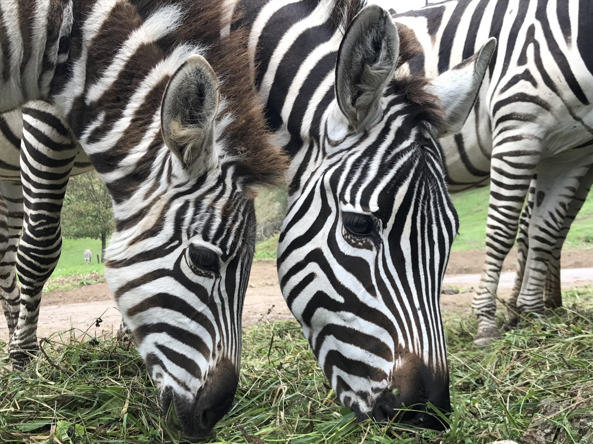
This wildlife park and natural reserve is built in a reclaimed mine, and unlike an ordinary zoo, gives the animals SO much room to roam. It is really beautiful. For the entrance fee of €23 (which kind of broke our daily budget), you can enter the park, drive the entire way around to see the animals, and, if you choose, take the gondolas to have a bird’s eye view of the entire park! We saw so many animals. The day we went was a bit cloudy, definitely sweater weather, and it wasn’t nearly as busy as I imagine a beautiful summer day would be. We had the gondola to ourselves!
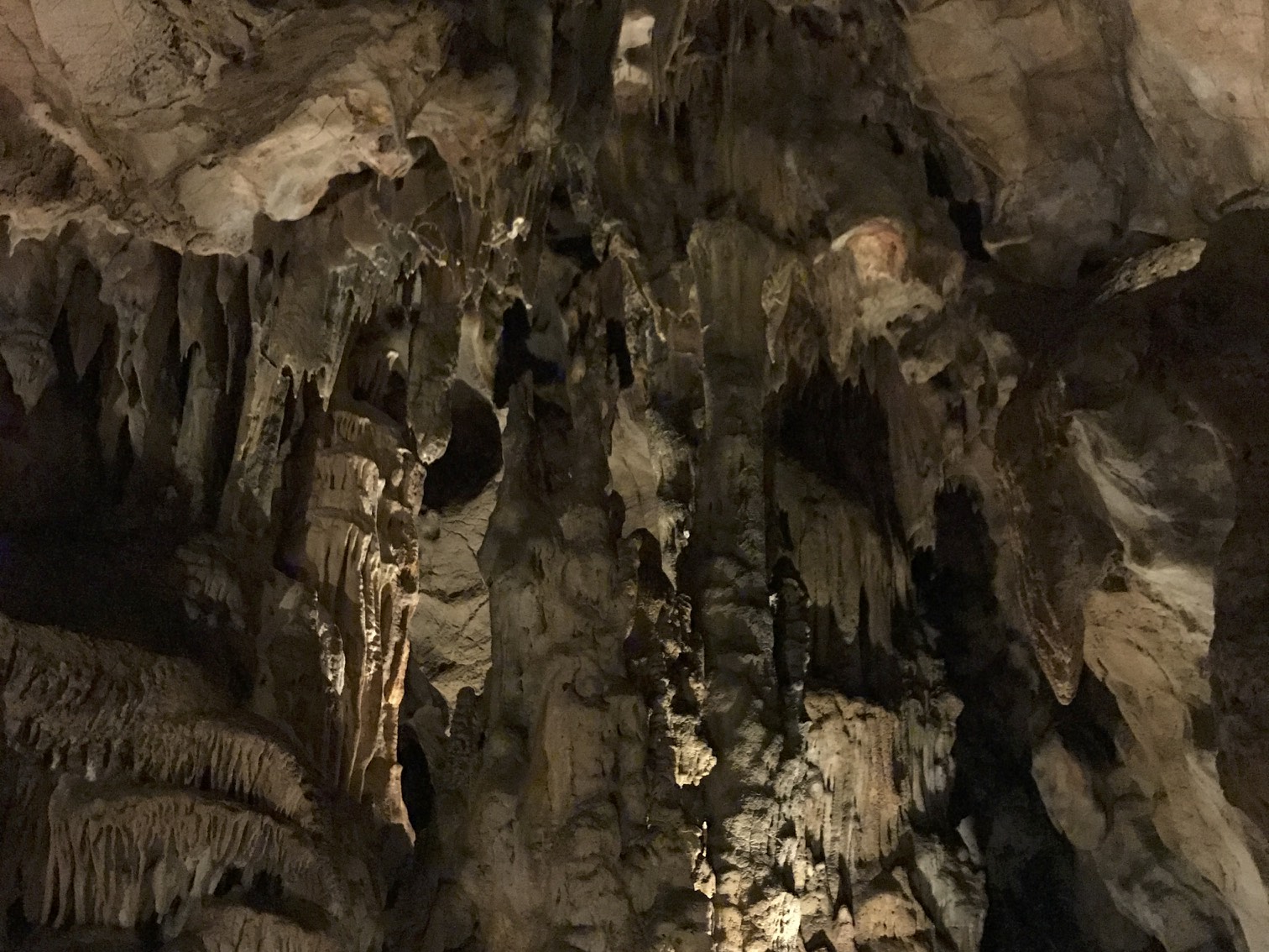
The cave of El Castillo is a cave boasting prehistoric art. Man, these caves are cool. I love wandering through and imagining the human that painted the art we are looking at. El Castillo is a great cave to see. You can go through the actual cave! The tours are only in Spanish, but our guide was able to explain a bit in English. It only costs €3 to enter!
The other cave we went to is the Cave of Altamira. This also costs €3 to enter, but is just a replica of the real thing. It is still very cool to see the art and learn about the mysterious people who painted it. On Friday mornings at 10:30am, there is a lottery and the five winners get to go into the real cave! We tried our luck and didn’t win, but maybe you’ll be luckier!
Spain isn’t all sangrias and tinto de verano. In the northern beach city of Gijón, cider is the drink of choice. All throughout downtown are siderias, special bars that serve only cider (and food of course). It is brewed naturally and so has no carbonation. Because of this, the cider is always poured in the glass from arms length to create bubbles, and is consumed immediately while the cider is still frothy. We had no idea this was the thing. We just thought the bartender at the first sideria we went was an absolute maniac. Until we went to the next sideria, and the server poured our cider the same way.
The Picos de Europa are a totally spectacular mountain range in the north of Spain. Famous for the hiking trails with ocean views, they are a must see for anyone traveling to the north of the country. The hiking trails vary in difficulty, and they are all beautiful. Here are three hikes you can do in the Picos de Europa, plus how to get there, and their difficulty.
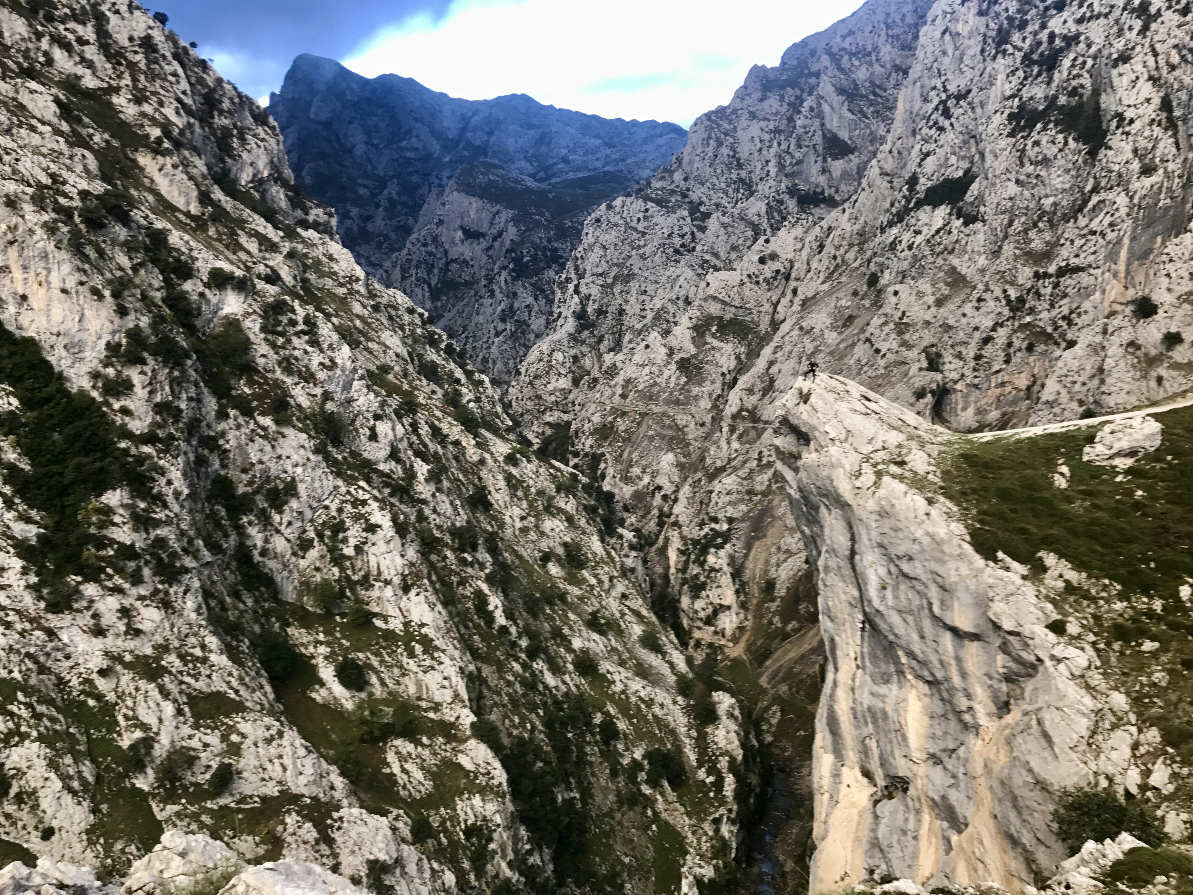
This one was the easiest walk we did in the Picos. It typically begins in Poncebos and the end point is Cain, although if you want to do it the other way, I don’t see why not. The path snakes along the gorge of the river Cares, and the hike has been dubbed “the garganta divina” or “the divine gorge.” It truly is divine. The first two kilometres of the walk are uphill, but the rest is relatively flat. But, just because there isn’t much elevation gain, doesn’t mean it isn’t a hike. It’s a 22km round trip from Poncebos to Cain. A lot of folks end up doing the hike one way and then taking the shuttle bus back. We thought about it, but it’s a two hour bus ride and I do not know how much it costs. We drove right up to the trailhead in Poncebos and left our van there. We did the hike in October, and we weren’t alone. I imagine if you are here in July or August, it would be WAY busier.

Bulnes is a small village perched high on a mountain top. In 2001, a funicular was built up to the village, to the delight of the locals. You can take the funicular up and go for a nice day hike around the top, which was our original plan, until we arrived at the funicular and discovered it is a €23 round trip (a bit out of our budget)! Next to the funicular is the original path that locals took to and from the village before 2001. We decided to hike it. We decided this path should be called The Cheapskate Path, for it is used only by cheapskates who can’t, or don’t want to, afford the funicular. The hike is about an hour. You will pass many other cheapskates on the way. Bulnes is a very quaint little village. Most of the bars and restaurants offer a menu del dia, which is typically an appetizer, a main course, a dessert, a coffee or tea, and water or wine. They normally cost about €8-12, depending where you are. From Bulnes there are more day hikes you can do, up to different summits or refugio huts. We had our lunch and hiked back down.

Out of Fuente Dé is an impressive gondola that takes you up 753m in 3 minutes. A round trip costs €17. The gondola spits you out at the top and from there, you will find many different hiking trails. We chose the summit of the Torre de los Horcados Rojos, mostly because it is a four hour round trip hike with a decent elevation gain, but also because it is very fun to say. This is definitely a bit more difficult than the other hikes we did. The two hours up to the end of the marked trail is entirely uphill, and of course, the last 20 minutes is a scramble to the summit. The summit is magnificent, boasting views of the ocean picture framed in between peaks. One of the most beautiful hikes I have done in Europe (and I’ve done a few! You can read about Switzerland, Austria, and Germany).
Hiked out? If you want to try something different, read about how to do a via ferrata in the Picos here!
The Picos de Europa are a totally spectacular mountain range in the north of Spain. Famous for the seemingly never-ending hiking trails, this natural park is a must-see when in the north of the country. If you are hiked out though, there are other activities to try! When we were tired of hiking, we did a via ferrata! A via ferrata is a mountain climb equipped with fixed ladders, cables, and bridges. It is kind of like rock climbing, but with steps and handles. It was my first time trying it, and we wanted to do an easy one. We called up Javier at Guiatrek, rented the equipment for a very reasonable €20, and were off!
Camaleño is a beginner/intermediate via ferrata, perfect for first timers. We parked the van at the trailhead, put on our harnesses, helmets, and gloves and began up the hill. When we reached the wall, I got nervous. I looked up the wall and saw the metal hooks and handles sticking out, until I couldn’t see them anymore because they were too high up. Phew. I began shaking in my boots a little bit.

There is really just one rule in a via ferrata. You have two carabiners on your harness. The one rule is to only clip and unclip one at a time. The cable that runs up along the side of the ladders and handles has breaks in it every few metres. Once you reach a joint, unclip one carabiner, clip it to the next bit of cable. Once it is clipped, only then can you unclip the next one and clip it again. The point is to always be attached to the cable, or as they call it in Spain, the lifeline.

Up and up and up we went. We climbed past two mountain goats, who were very confused as to why humans were up on a wall like this. We finished the first leg of the climb, and then the second. After the second, the trail diverges here, to an easy bit, and a more difficult bit. We decided to take the more difficult bit because it took us to a Tibetan bridge; a bridge that is made up of one cable for your feet, a cable on either side for each hand, and a cable above for your caribiners.

I hooked on to the cable above my head, grabbed the ropes on either side, and began my walk. “Don’t look down,” I told myself. My heart was pounding in my throat, my stomach was fluttering like a butterfly. I laughed and shrieked the entire way across. “I’m going to cry!” I laugh/yelled. I made it!

This was the perfect first try at a via ferrata. I am so proud of myself that I was able to finish such a crazy climb. I would absolutely recommend it to anyone! As always, commetn below with questions and comments about this or any other via ferrata experiences you have had!
And if a via ferrata doesn’t sound like your thing, stay tuned for more tips for travel in the Picos!